A History of changes to the mound over the last 100 years. This information was compiled by our founding Friends member, Fen Tyler, who very sadly passed away in May 2020. Fen was instrumental in galvanising opposition to plans for development of housing on the site in the 1960s and 2013.
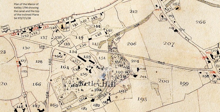
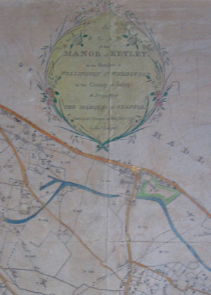
original plans courtesy of Shropshire Archives ref: 972/7/1/38
These plans of the Manor of Ketley, dated 1794, show the site and its boundaries much as we know them today, and the canal is clearly shown as it was then in its heyday. By this time the mineral wealth of East Shropshire was being voraciously exploited to supply the ironworks of Coalbrookdale and Ketley. The plan shows a “Supposed Extent of Stone Coal” measure to the west of the site. However, Paddock Mound, as we now know it, was not formed by spoil from coal but from pennystone (ironstone) mining.
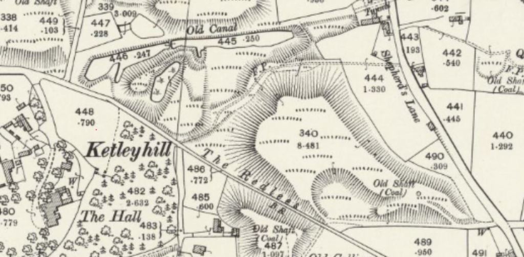
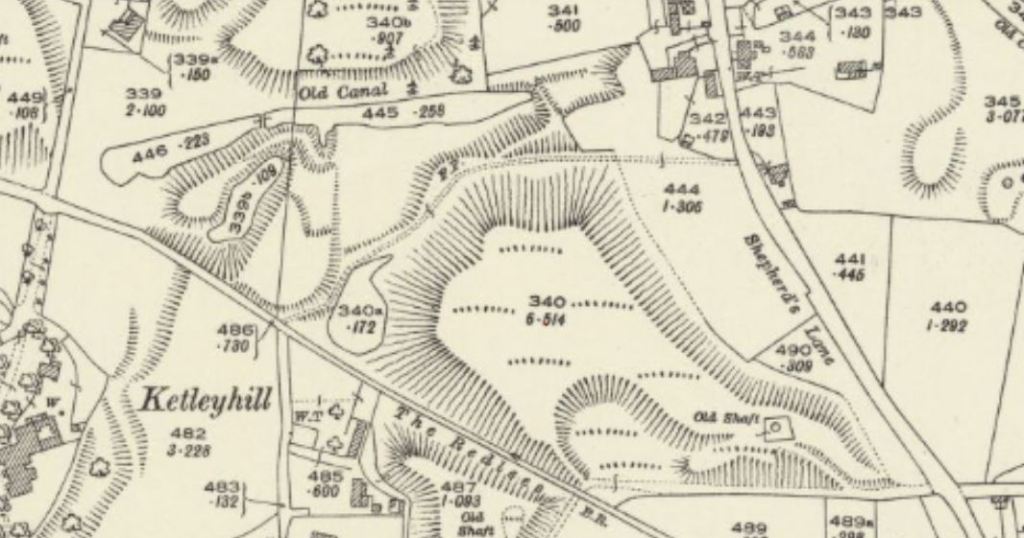
These two maps – taken from the Ordnance Survey sheet XXVI.14 Shropshire, courtesy of the National Library of Scotland website, were surveyed in 1901 and 1925. They show slight changes to the shape of the canal remnant, but most noticeably, the top pool was not there in 1901, but was fully formed by 1925. There is a slight spring / seepage of water from below the slope – where waste soil from the pits had gradually been dumped over the previous 100 years and more. This seems to have been trapped by the raised footpath, which was created before the 1st edition OS in 1880, from Red Lees to Shepherds Lane. These maps have been added to the site as a possible answer to the questions and discussion posed on facebook by Norman Pagett – any further thoughts, comments or research would be really welcome!
A typical pennystone seam comprises a matrix of nodules of ironstone in clay. At Paddock Mound the clay containing the ironstone would have been mined and then dumped above and around the shaft to weather. Normally women would be employed to pick the nodules of ironstone from the clay, which they would then carry in wooden boxes on their heads. Since the clay was spread all around the shaft, the heap (mound) grew in height and the shaft deepened.In the early days of mining it was normally a requirement of the lease that when the mine was exhausted the shaft should be filled and the land returned to its original state. Later on it was common for shafts to be capped, sometimes with a brick dome. This may have been the case at Paddock Mound. Now, the old shafts have been securely capped with reinforced concrete.
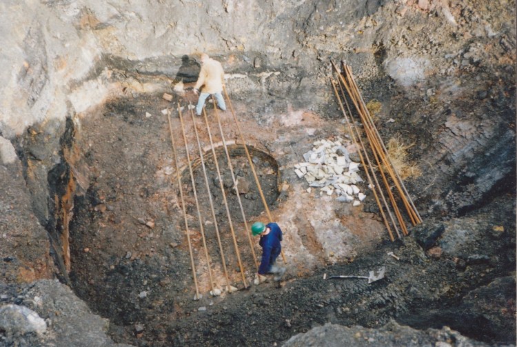
This photo shows the main Paddock Mound mine shaft being capped in 1992 See more images of the work here. Residues of iron ore and coal can clearly be seen.
Over the past 50 years thousands of similar small mineshafts have been capped in the Telford area.
The “Plantation” mound to the north is heavily wooded and not easily accessible. It too had a mineshaft capped in 1992. A substantial part of this mound was previously owned by Ketley “Good Companions” but this has now passed into public ownership. There are however small parts of this mound in the possession of householders in School Lane. It is supposed that the mound derived its name from the fact that it was planted with trees in the 19th century. This was not uncommon when mounds fell into disuse (e.g. Barnetts Leasow in Broseley).
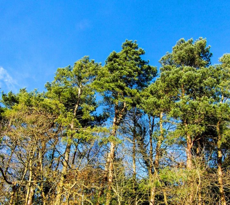
Scots Pine on the Northern – Plantation Mound – between Holyhead Road and the Canal – shown after clearing willow from the water – this area is less accessible for humans, but has bird and bat boxes installed to encourage more wildlife.
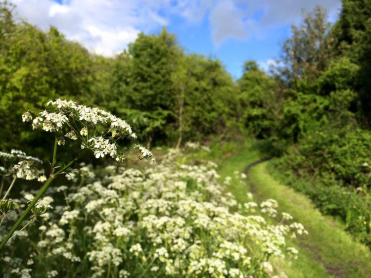
The Paddock Mound site actually comprises two mounds. The one to the south is more accessible and well used by walkers and nature lovers. By their nature, the mounds are hilly but really varied, with quiet wooded areas and open views.
In the first half of the 20th century the site was used for farming and cattle roamed freely. It is not known who owned the land but it was let to Harry Whittingham who lived at 104 Potters Bank with his two sisters, one of whom, Nellie, kept the house. Their sister, Miss Whittingham, taught at the Ketley School, Holyhead Road (now the Community Centre). Adjacent to 104 were old stone farm buildings but by the 1960’s these were largely derelict and finally disappeared when the plot was used by Severn Trent to build huge drainage chambers.
Brian Richards, recalls that Harry would regularly chase off children found to be anywhere other than on the footpaths. Perhaps it was down to Harry being a special constable ! Harry also delivered milk in his horse and trap

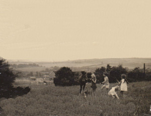
By the 1960’s Harry had retired and the land had effectively become public open space and was heavily used for recreational purposes.
However, in the 1950’s significant parcels of land in Ketley had been acquired by the developers, K.E. Millard & Co. and this included the Paddock Mound site. They obtained outline planning permission (May 1960) for the Woodside Road development from Wellington Rural District Council and when full permission followed, building commenced soon after.
In February 1961 outline planning permission was also granted for the erection of dwelling houses and construction of roads on the 11 acre site we know as Paddock Mound.
However, in the mid 60’s progress on the Woodside Road estate stalled. Some readers will remember the clay wasteland between the top of Woodside Road and the cemetery. The delay was probably down to financial issues but also the fact that the lower land in Ketley was experiencing serious flooding.
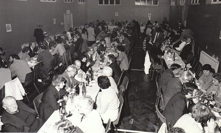
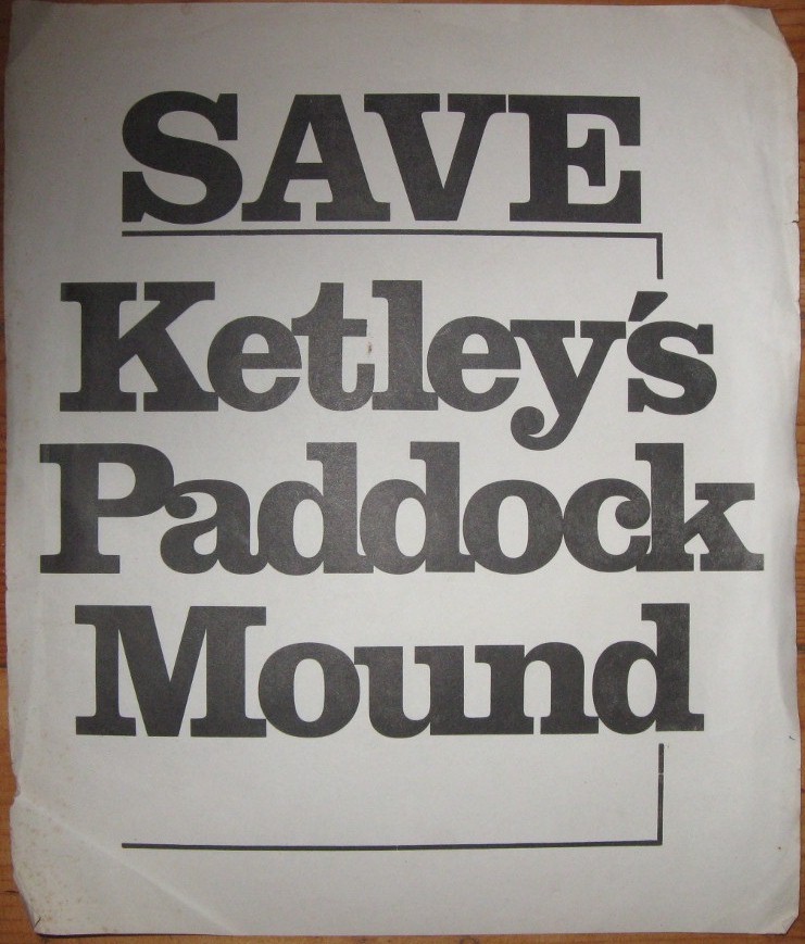
In 1967, Fen Tyler, a Wellington RDC councillor, raised the matter of the future of the Paddock Mound site with the District Council and also with the Telford Development Corporation, by now the prime mover in the area’s future. He received a sympathetic hearing in both cases but it was an unavoidable fact that K.E. Millard retained outline planning permission for the site. By the 1970’s a ‘head of steam’ was growing in the locality with many residents opposed to further development and the Ketley Paddock Mound Preservation Group was formed.
The decision of the chair of the Local Enquiry, published in June 1983 made very good reading !!
“From my inspections of the site and surroundings and the representations that have been made by and on behalf of a considerable number of residents both at the Inquiry and by letter, I am of the opinion that Paddock Mound is indeed an important, and maybe unique, landscape feature, which provides a significant measure of relief for the residents in this area of the New Town when such relief elsewhere might have.to be contrived at some considerable expense….. In my opinion, therefore, neither houses nor roads ought to be built upon the appeal site”
At the time local residents thought the battle to save Paddock Mound was finally won. It wasn’t !
In 1985 the site passed into public ownership when the site was acquired by Wrekin District Council. By 1990 the new owners had enclosed the two pastures to the east of the site and had let them for grazing.
For reasons it never disclosed and certainly not because of a further Public Inquiry, the local authority in 1992 unilaterally changed the status of the paddock area describing it as “grazing outside site boundary”. This was followed in 1997 by their application (W97/0737) for planning permission for housing development on the paddock. This was met with stiff resistance from local residents and at the Plans Board the Chair used her casting vote to turn down the application.
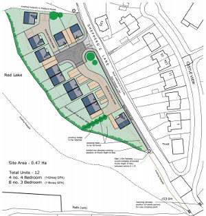
In 2013 Telford & Wrekin Council followed the example of Wrekin Council and also made an application for development (TWC/2013/0824) of the paddock area. The plan was for road widening of Shepherds Lane and a development of 12 houses.
This was met with energetic resistance from the recently formed Friends of Ketley Paddock Mound, Ketley Parish Council, district councillors, the Shropshire Wildlife Trust and many other groups. More than 150 objections were posted on the Council’s website.
In the event the application was withdrawn hours before the Plans Board was due to meet.
So if the reader has stayed the course he/she might be forgiven for asking: “so is the site safe now ?” Well, the signs are good. The site has been awarded Local Wildlife Site status, and at the time of writing (December 2015) it is to be placed on a list of 11 local sites scheduled as Local Nature Reserves. Whilst neither designation gives absolute protection it is very unlikely that applications for development will be made in the future.
A tripartite arrangement for the management and maintenance for the site is now in place with FoKPM, Ketley Parish Council, and Telford & Wrekin Council officers meeting regularly.
Ketley Parish Council in association with FoKPM was awarded a grant of £30,000 from the Community Pride Fund for upgrades to the entrances and paths of Paddock Mound. The work contract was awarded to Neil Overton of Ketley – see more details of this project here. This work was carried out in 2015-16 and featured a new path alongside the Shepherds Lane hedgerow, replacing the K50 footpath which was effectively lost by enclosure. Work on the top entrance in Shepherds Lane involved re-grading the surface and setting new gateposts. The old wrought iron gate was refurbished by local metalsmith, Adrian Reynolds. It features the words “Ketley Paddock Mound”
Apart from the convenience of having a path for walkers wishing to traverse the site and to avoid traffic hazards, the new path is emblematic of a great future for this well-loved open space.
